Geography

“…geography underpins a lifelong ‘conversation’ about Earth as the home of humankind…”                         Geographical Association

What does Geography look like at Meldreth Primary?
Our approach inspires in pupils a curiosity and fascination about the world and its people that will remain with them for the rest of their lives. Teaching aims to equip pupils with knowledge about diverse places, people, resources and natural and human environments, together with a deep understanding of the Earth’s key physical and human processes. As pupils progress, their growing knowledge about the world will help them to deepen their understanding of the interaction between physical and human processes, and of the formation and use of landscapes and environments. Geographical knowledge, understanding and skills provide the framework and approaches that explain how the Earth’s features at different scales are shaped, interconnected and change over time.
 
Our Curriculum Aims
Our curriculum aims to ensure that all pupils:
  • develop contextual knowledge of the location of globally significant places – both terrestrial and marine – including their defining physical and human characteristics and how these provide a geographical context for understanding the actions of processes
  • understand the processes that give rise to key physical and human geographical features of the world, how these are interdependent and how they bring about spatial variation and change over time
  • are competent in the geographical skills needed to:
    • collect, analyse and communicate with a range of data gathered through experiences of fieldwork that deepen their understanding of geographical processes
    • interpret a range of sources of geographical information, including maps, diagrams, globes, aerial photographs and Geographical Information Systems (GIS)
    • communicate geographical information in a variety of ways, including through maps, numerical and quantitative skills and writing at length have a thorough understanding of esafety and how it affects them and others
Curriculum Content 
Early Years
Geography is taught in the Early Years Foundation Stage (EYFS) through the area of learning ‘Understanding the World’. Initially the children will learn about their own home, school environment including Melwood and the local surrounding area. This awareness is extended through providing first hand experiences, visiting places and by finding out about different environments in books and through using other technology.

Pupils learn about their community and the world in which they live. They develop their understanding of similarities and differences. They talk about their environment and make observations of the place they live and their environment. They will begin to ask questions, explore, investigate and make comparisons.

Key Stage 1
Pupils develop knowledge about the world, the United Kingdom and their locality. They start to understand basic subject-specific vocabulary relating to human and physical geography and begin to use geographical skills, including first-hand observation, to enhance their locational awareness. Pupils are taught to:
 
Locational knowledge
  • name and locate the world’s 7 continents and 5 oceans
  • name, locate and identify characteristics of the 4 countries and capital cities of the United Kingdom and its surrounding seas
  • understand geographical similarities and differences through studying the human and physical geography of a small area of the United Kingdom, and of a small area in a contrasting non-European country
Human and physical geography
  • identify seasonal and daily weather patterns in the United Kingdom and the location of hot and cold areas of the world in relation to the Equator and the North and South Poles
  • use basic geographical vocabulary to refer to key physical features, including: beach, cliff, coast, forest, hill, mountain, sea, ocean, river, soil, valley, vegetation, season and weather o key human features, including: city, town, village, factory, farm, house, office, port, harbour and shop Geographical skills and fieldwork
  • use world maps, atlases and globes to identify the United Kingdom and its countries, as well as the countries, continents and oceans studied at this key stage
  • use simple compass directions (north, south, east and west) and locational and directional language [for example, near and far, left and right], to describe the location of features and routes on a map
  • use aerial photographs and plan perspectives to recognise landmarks and basic human and physical features; devise a simple map; and use and construct basic symbols in a key
  • use simple fieldwork and observational skills to study the geography of their school
 
Key Stage 2
Pupils extend their knowledge and understanding beyond the local area to include the United Kingdom and Europe, North and South America. This includes the location and characteristics of a range of the world’s most significant human and physical features. They develop their use of geographical knowledge, understanding and skills to enhance their locational and place knowledge. Pupils are taught to:
 
Locational knowledge
  • locate the world’s countries, using maps to focus on Europe (including the location of Russia) and North and South America, concentrating on their environmental regions, key physical and human characteristics, countries, and major cities
  • name and locate counties and cities of the United Kingdom, geographical regions and their identifying human and physical characteristics, key topographical features (including hills, mountains, coasts and rivers), and land-use patterns; and understand how some of these aspects have changed over time
  • identify the position and significance of latitude, longitude, Equator, Northern Hemisphere, Southern Hemisphere, the Tropics of Cancer and Capricorn, Arctic and Antarctic Circle, the Prime/Greenwich Meridian and time zones (including day and night)
Place knowledge
  • understand geographical similarities and differences through the study of human and physical geography of a region of the United Kingdom, a region in a European country, and a region in North or South America Human and physical geography
  • Describe and understand key aspects of 
    • physical geography, including: climate zones, biomes and vegetation belts, rivers, mountains, volcanoes and earthquakes, and the water cycle
    • human geography, including: types of settlement and land use, economic activity including trade links, and the distribution of natural resources including energy, food, minerals and water Geographical skills and fieldwork
  • use maps, atlases, globes and digital/computer mapping to locate countries and describe features studied
  • use the 8 points of a compass, 4- and 6-figure grid references, symbols and key (including the use of Ordnance Survey maps) to build their knowledge of the United Kingdom and the wider world
  • use fieldwork to observe, measure record and present the human and physical features in the local area using a range of methods, including sketch maps, plans and graphs, and digital technologies
Human and physical geography
  • understand, through the use of detailed place-based exemplars at a variety of scales, the key processes in:
    • physical geography relating to: geological timescales and plate tectonics; rocks weathering and soils; weather and climate, including the change in climate from the Ice Age to the present; and glaciations, hydrology and coasts
    • human geography relating to: population and urbanisation; international development; economic activity in the primary, secondary, tertiary and quaternary sectors; and the use of natural resources
  • understand how human and physical processes interact to influence and change landscapes, environments and the climate; and how human activity relies on the effective functioning of natural systems Geographical skills and fieldwork
  • build on their knowledge of globes, maps and atlases, and apply and develop this knowledge routinely in the classroom and in the field
  • interpret Ordnance Survey maps in the classroom and the field, including using grid references and scale, topographical and other thematic mapping, and aerial and satellite photographs
  • use Geographical Information Systems (GIS) to view, analyse and interpret places and data
  • use fieldwork in contrasting locations to collect, analyse and draw conclusions from geographical data, using multiple sources of increasingly complex information
Download our whole school curriculum plan for Geography by clicking the link below
We are members of the Geographical Association
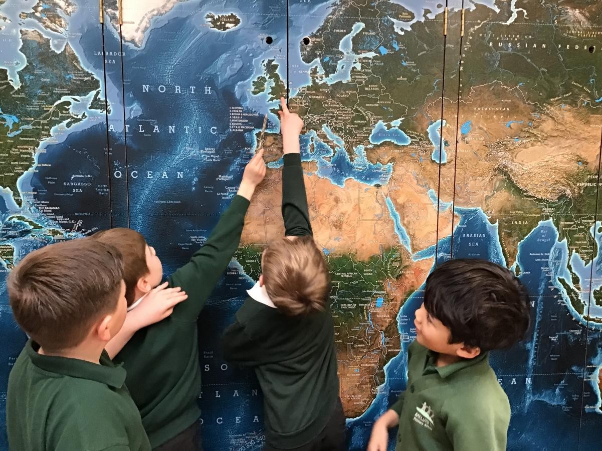
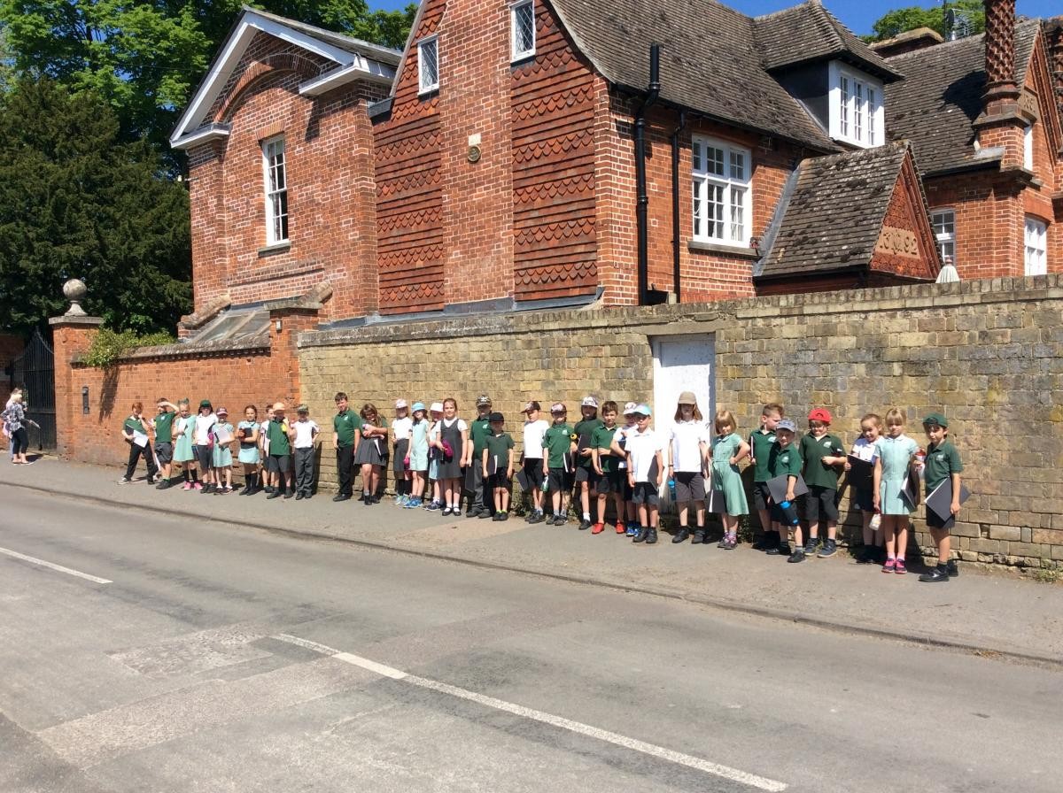
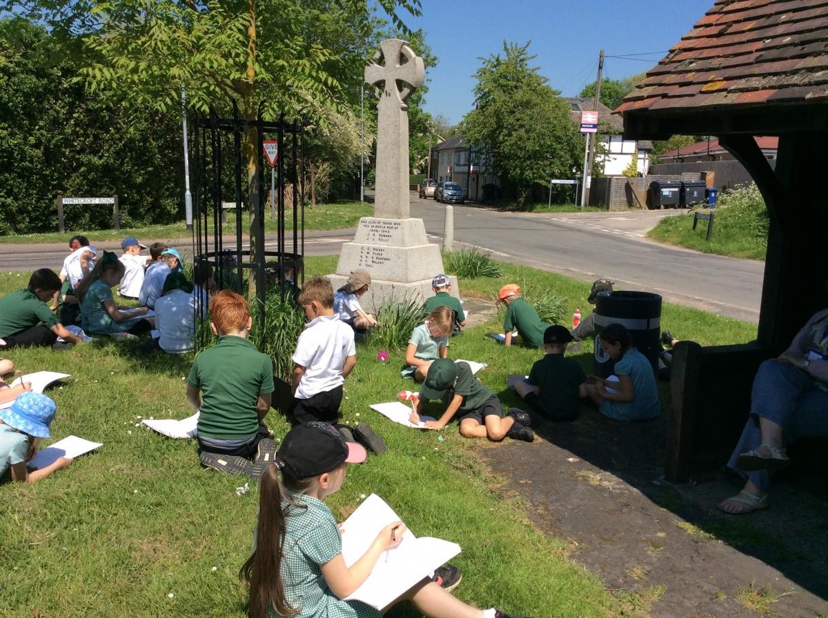
  Geographical Association - Posted by TribePost Ltd